A Partnership of UConn and Eversource
Eversource Energy Center
Recent Storms
Hurricane Dorian: Hurricane Dorian flooding in Bahamas Derived from Satellite SAR Observations
On Sunday, September 1st, Hurricane Dorian made landfall on Great Abaco Island unleashing unprecedented destruction on the Northern Bahamas, causing at least 40 deaths. Dorian was characterized by extreme wind gusts – up to 220 mph – extensive coastal flooding – up to 20 feet storm surge – and impressive precipitation – up to 40 inches.
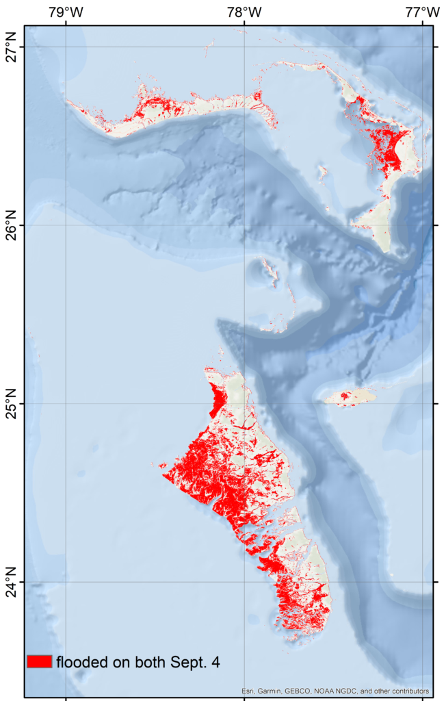
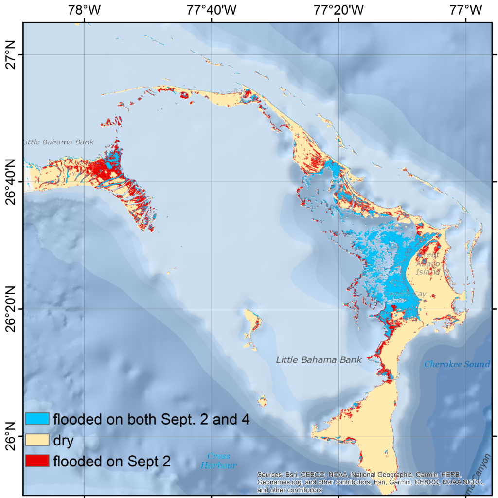
Researchers at the Eversource Energy Center of the University of Connecticut are studying the event through images acquired by the synthetic aperture radar (SAR) mounted on Sentinel-1 satellite of the European Space Agency, which are effective in any weather conditions. The inundated areas are delineated in red by the RAdar Produced Inundation Diary (RAPID) system, as shown below. RAPID integrates radar polarimetry, multisource high-resolution remote sensing/data products, and machine learning techniques to minimize commission/omission error without human interference. The derived flooding map shows that in both the Great Abaco and Grand Bahama islands coastal flooding reached areas up to 5 miles inland. RAPID will use SAR images acquired during subsequent days to map the recession of the flooding, which can support emergency response.

