NRT Inundation Maps of the European Flood
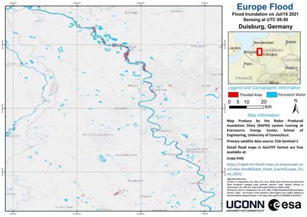
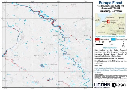
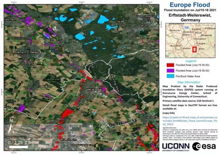
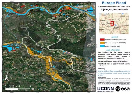
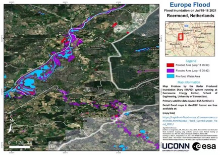
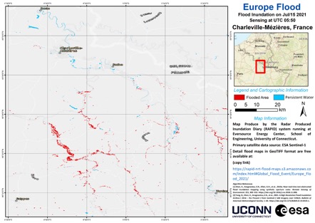
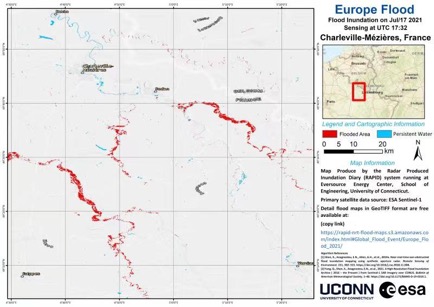
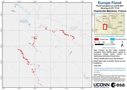
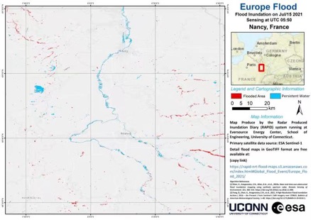
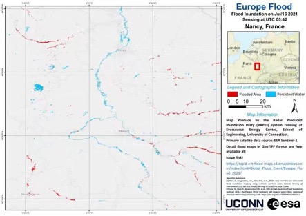
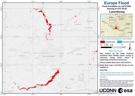
The UConn team at the Eversource Energy Cener has mapped European flood extent from Jul 15 to 17 spanning West Germany, France, Netherlands, and Luxembourg using a near-real-time tool, the Radar Produced Inundation Diary (RAPID, patent published), based on Sentinel-1 Synthetic Aperture Radar (SAR) satellite. The maps are also provided to the Dartmouth Flood Observatory (DFO). Original maps (created by Qing Yang) in GeoTiff format can be found via Amazon Web Service (AWS). Publications describing the algorithm and the CONUS system can be found online.
Published: July 26, 2021
Categories: Recent News
Available Archives